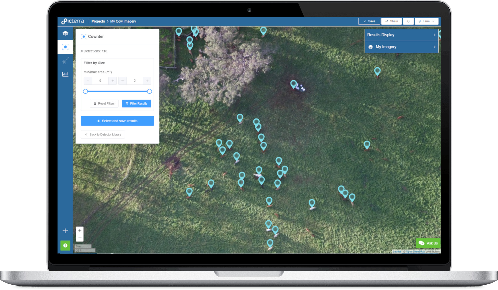
Cownter
Online tool designed to detect and count cattle from aerial imagery, optimised for the Australian landscape.
Online tool designed to detect and count cattle from aerial imagery, optimised for the Australian landscape.
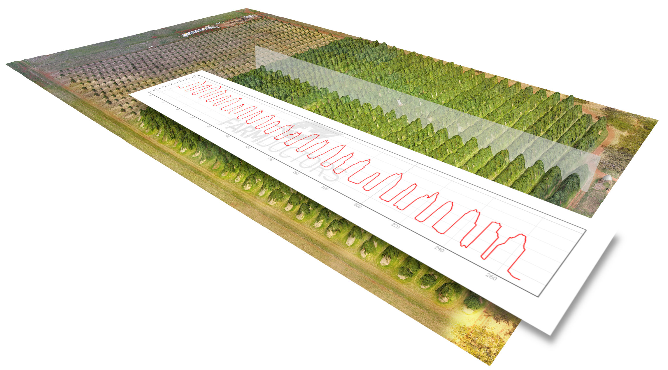
Farm Doctors trust in aerial imagery as the best method for crop uniformity investigation. From the sky we can identify replanting opportunities (before it is too late to sow again), count how many trees are growing, estimate plant biomass and check the average plant height at different paddock sections. This helps you monitoring the profit potential of your crops.
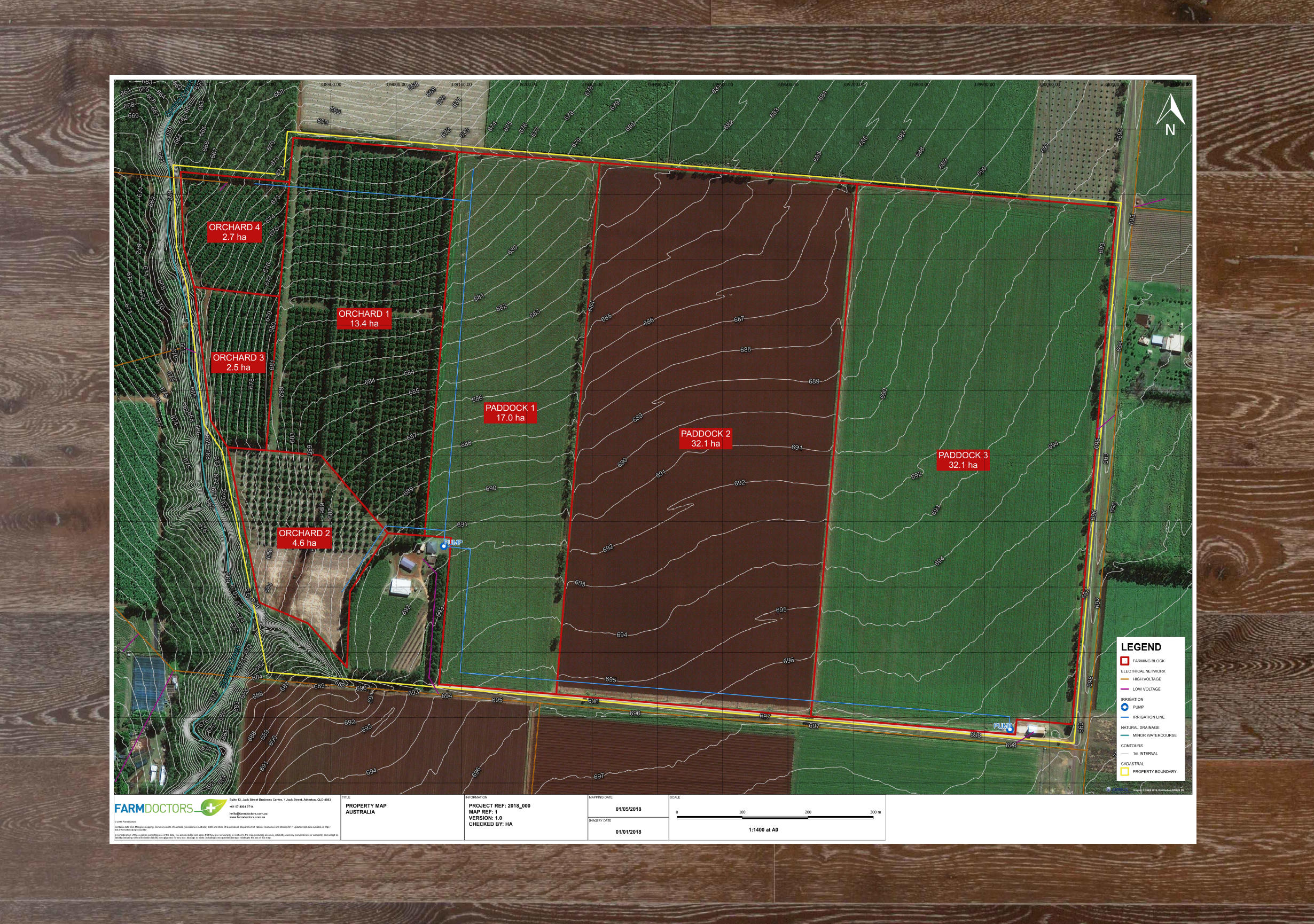
Get an updated bird’s-eye view of your properties, and use it for high-level paddock planning, asset mapping and Freshcare program accreditation and compliance.
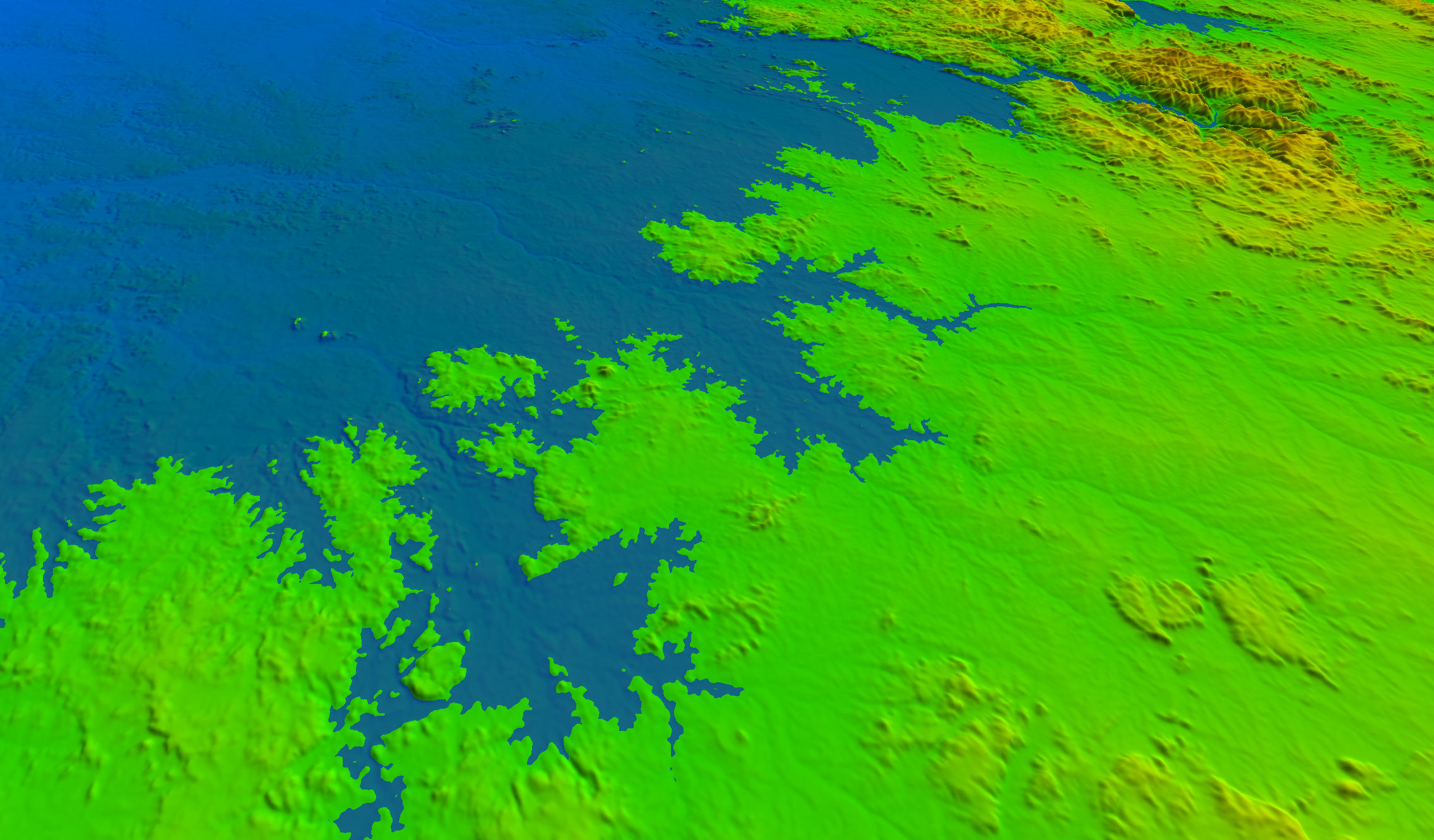
By using aerial imagery or ground data collected by your own tractors, Farm Doctors will create 3D topographic models of your land, providing you with the foundation for better farming decisions and improved yield.