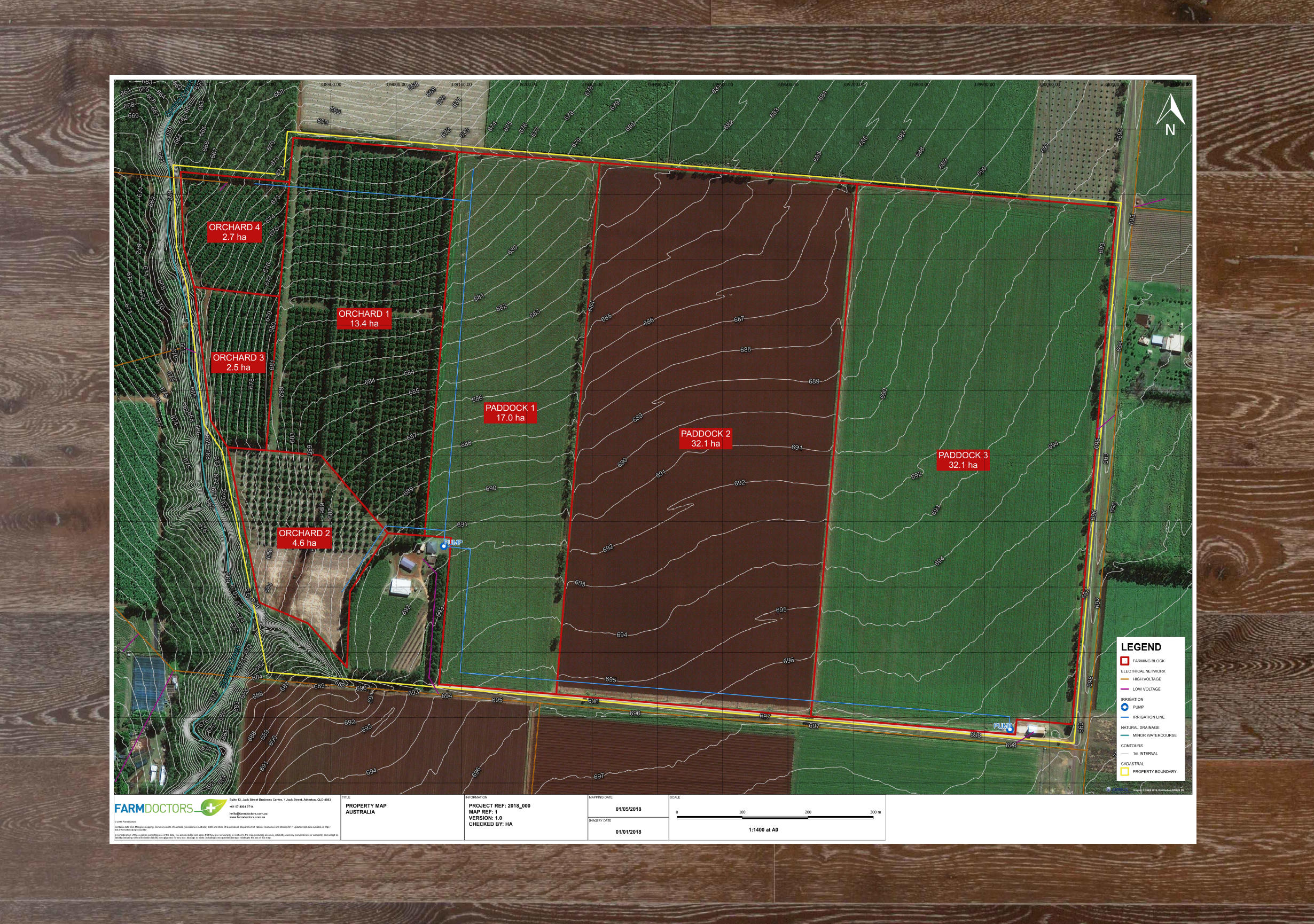
Get an updated bird’s-eye view of your properties, and use it for high-level paddock planning, asset mapping and Freshcare program accreditation and compliance.
Our geospatial experts will help you choosing between the exceptional coverage of satellite and the improved resolution of drone imagery, and will map as many layers of information as you need.
Benefits
- Design paddock improvements based on updated aerial imagery
- Locate and map strategic assets in your property
- Prepare your operation for accreditation programs, such as Freshcare
- Have your land mapped by different soil textures (visual classification)
- Validate your property boundaries in the comfort of your office