A new perspective in cattle counting
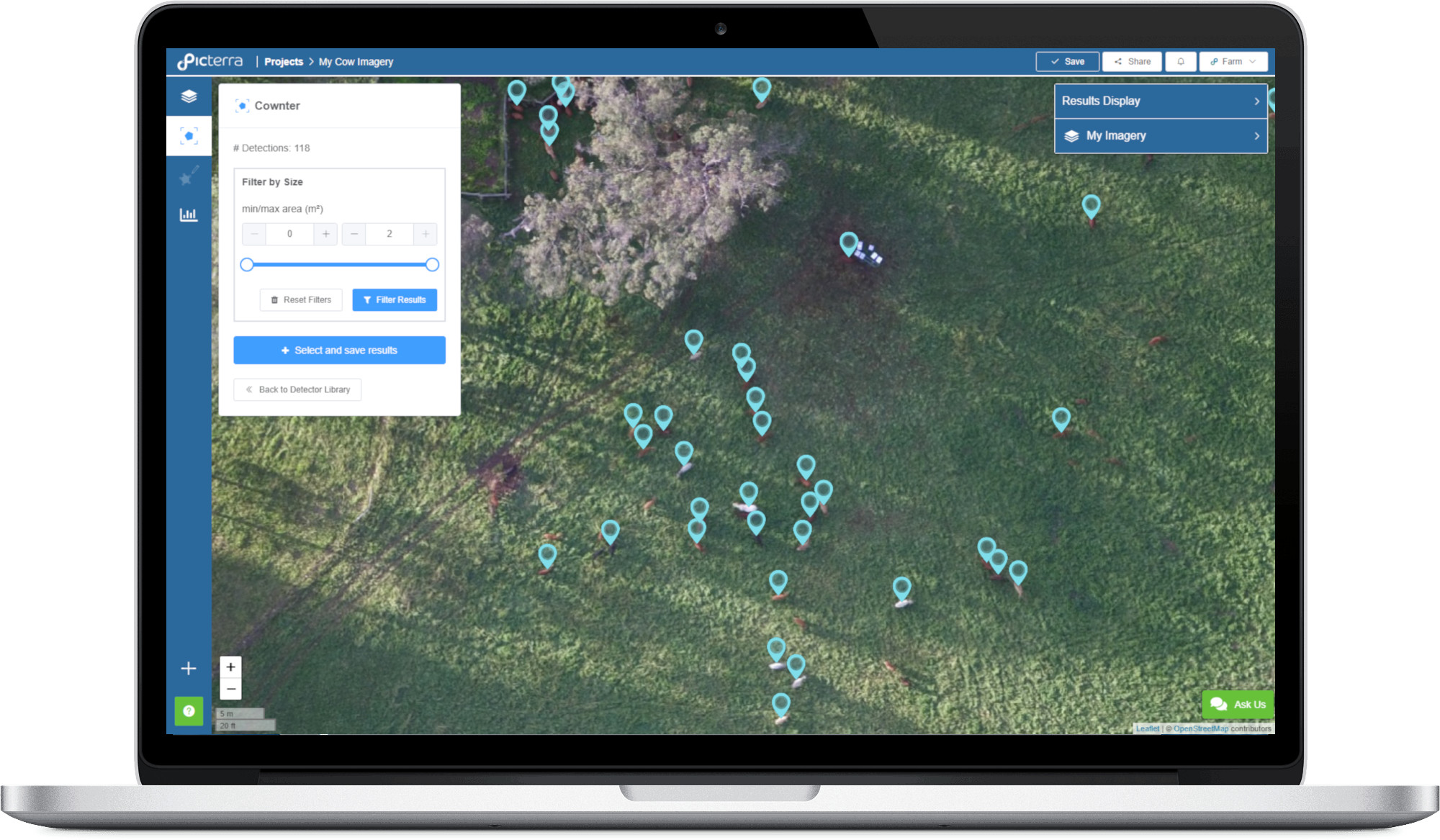
Cownter is an online tool designed to detect and count cattle from aerial imagery, optimised for the Australian landscape.
Online and easy-to-use
Developed in partnership with Picterra, Cownter was designed to help producers to detect and count animals, and to allow for more informed business decisions, particularly in times of duress.

Use your own aerial imagery
The detector supports high-resolution aerial imagery (including drone imagery), and was optimised for 10 cm/pixel photos or orthomosaics. Additional imagery requirements:
- Georeferenced to the WGS84 coordinate system (latitude/longitude);
- Captured in a vertical orientation (the camera should be pointing straight down);
- Supported formats are TIF, JPG and PNG;
- Each individual file size should be limited to 4GB.
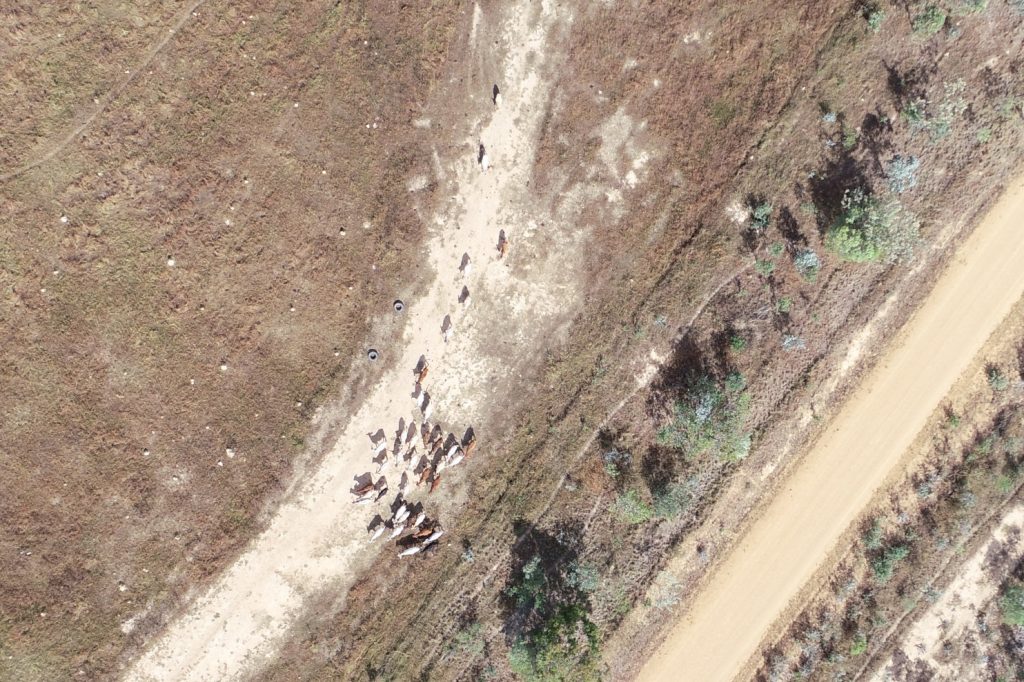
Tailored to Australia
Cownter was trained to count cows in a wide variety of Australian environments. Queensland was our laboratory, offering distinct and challenging soil and vegetation backgrounds for automatic cattle detection.
The team
